Auckland — New Zealand's largest city, home to 1.7 million people (approximately one-third of New Zealand's total population), built across a narrow volcanic isthmus between two harbours (the Waitemata to the east, opening to the Hauraki Gulf and the Pacific; the Manukau to the west, opening to the Tasman Sea), its skyline defined by the Sky Tower (328 metres, the tallest free-standing structure in the southern hemisphere) and by the volcanic cones (50 volcanoes of various sizes dotting the urban landscape, many with parks at their summits offering 360-degree views) — is the commercial and cultural capital of New Zealand and the gateway through which 98% of international visitors arrive. The city's identity as the "City of Sails" derives from its extraordinarily high ratio of sailing boats per capita (the highest of any city in the world; the Waitemata Harbour is filled with yachts year-round) and from hosting the America's Cup regatta on three occasions (1995, 2000 and 2003, and the 2021 defence — the most recent being Emirates Team New Zealand's successful 2021 defence against Luna Rossa, the races visible from the Wynyard Quarter waterfront).
The Bay of Islands — a sheltered bay of 144 islands 3.5 hours north of Auckland on the Northland peninsula, the site of New Zealand's first permanent European settlement, the signing of the Treaty of Waitangi in 1840 (the founding document of modern New Zealand, signed between the British Crown and over 500 Māori chiefs), and some of the finest sailing, fishing and dolphin watching in the Pacific — is the principal day trip and short-break destination from Auckland: the combination of the historic significance (the Waitangi Treaty Grounds, the Russell colonial township, the Kerikeri mission station), the natural beauty (the enclosed bay, the dolphin populations, the seasonal fishing for marlin and kingfish), and the warmth (the Bay of Islands is several degrees warmer than Auckland year-round) make it an essential extension to any Auckland visit.
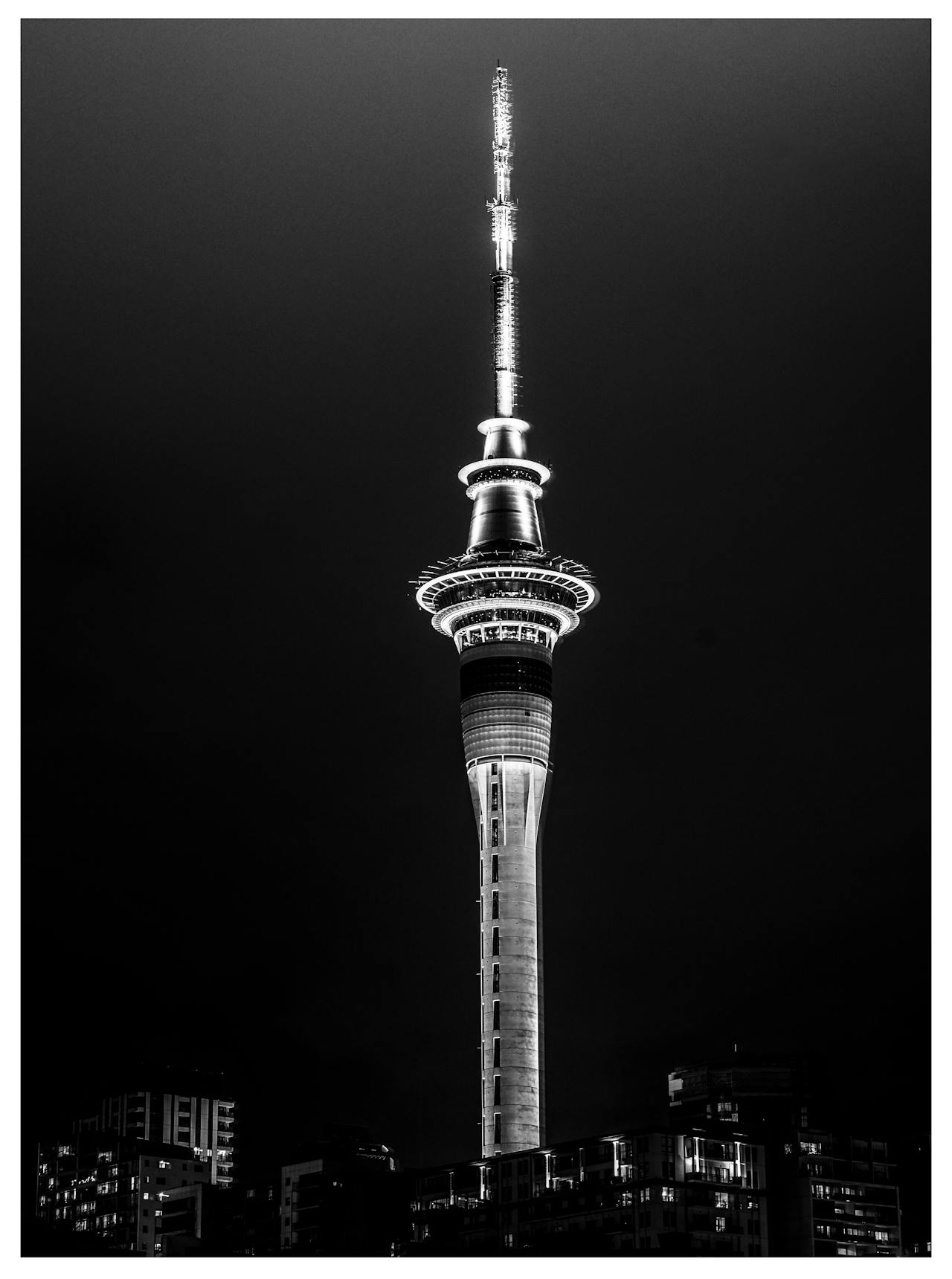
Auckland City — Sky Tower, Waitemata & Volcanoes
The Auckland Sky Tower — 328 metres, accessible from the Sky City complex on Federal Street (entry NZD 32 adult; open 8:30am–10:30pm; the SkyJump bungee descent NZD 225 for those wanting to fall 192 metres off the tower platform) — provides the clearest single view of Auckland's extraordinary isthmus geography: both harbours visible simultaneously from the observation deck, the volcanic cones scattered across the urban landscape (One Tree Hill/Maungakiekie, the most significant; Mount Eden/Maungawhau, the most accessible crater in the city), the Hauraki Gulf islands to the east, and the Manukau bar to the west. The Waitemata Harbour waterfront — from the Wynyard Quarter (the regenerated fisherman's wharf area with its Friday night food trucks, the weekend market and the maritime museum) to the Ferry Building (1912, the hub for the Hauraki Gulf ferry network) to the Viaduct Basin (the America's Cup village, now a restaurant and bar district) — is Auckland's finest public space: the harbour walk from the Wynyard Quarter to the ferry terminal (20 minutes) is the essential free morning walk. Devonport (a 12-minute ferry from the Ferry Building, NZD 11.50 return on the Fullers ferry; a Victorian seaside village at the foot of Mount Victoria, with cafés, galleries and a beach) is the finest short ferry excursion from Auckland city.
Bay of Islands — Dolphins, Sailing & History
The Bay of Islands — accessed from Paihia township (the main visitor hub, 3.5 hours north of Auckland by InterCity bus or car via State Highway 1) — has the finest dolphin-watching in New Zealand: the Interislander dolphins (bottlenose and common dolphins) are year-round residents of the Bay and are routinely encountered on the sailing and fishing charter boats that depart Paihia daily. Fullers GreatSights (the main operator; departing Paihia from approximately NZD 109 per adult for the "Cape Brett and Hole in the Rock" cruise — the most popular single activity in the Bay, a 4.5-hour circumnavigation of the Cape Brett headland passing the Hole in the Rock limestone arch through which the boat passes at low-swell) is the primary tourist activity. The R Tucker Thompson (a 1980s traditional topsail schooner, the finest sailing boat in the Bay, departing Paihia on day sails and overnight voyages; from approximately NZD 115 for a day sail) is the finest way to experience the Bay under sail. The Waitangi Treaty Grounds (2km from Paihia; entry NZD 50 including a guided tour, a kapa haka performance and access to all treaty-related buildings including the Treaty House of 1833) are the finest single historical destination in New Zealand.
Cape Reinga & the Northland Drive
Cape Reinga — the northernmost accessible point of New Zealand (the actual northernmost point, Cape Maria van Diemen, is inaccessible), a 2.5-hour drive from Paihia along State Highway 1, where the Tasman Sea and the Pacific Ocean visibly meet in a line of breaking waves seen from the lighthouse at the cape's tip — is a place of profound Māori spiritual significance: according to Māori tradition, the spirits of the dead travel down the Aupouri Peninsula to Te Rerenga Wairua (the leaping place of the spirits) at Cape Reinga and depart from this point for Hawaiki, the Māori homeland. The 90 Mile Beach (actually 88km; the long straight west coast beach of the Aupouri Peninsula, accessible by 4×4 only at most points but included in guided coach tours from Paihia as a beach drive; the sandboarding dunes at Te Paki are the highlight, with the Te Paki Sand Dunes rental NZD 15 for a sandboard) and the Kauri forests of the Waipoua Forest (the finest surviving kauri forest in Northland, containing Tāne Mahuta — "Lord of the Forest" — the largest living kauri tree in the world at 51 metres high and approximately 2,000 years old, accessible via a 10-minute boardwalk from State Highway 12, free entry) complete the Northland itinerary.